A week to remember (2)
GETTING HOME …
The trip home from our Christmas visit to the coast to Granite Glen was eventful.
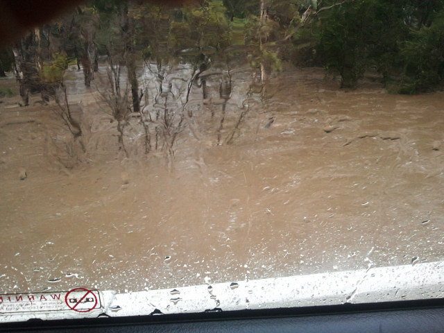
I guess we knew it would be, but travelling in extreme conditions is one of those things that you just need to keep your head down and forge ahead or you’d be a nervous wreck. The first creek we crossed came up to the top of the Prado’s wheels – and it was clearly rising.
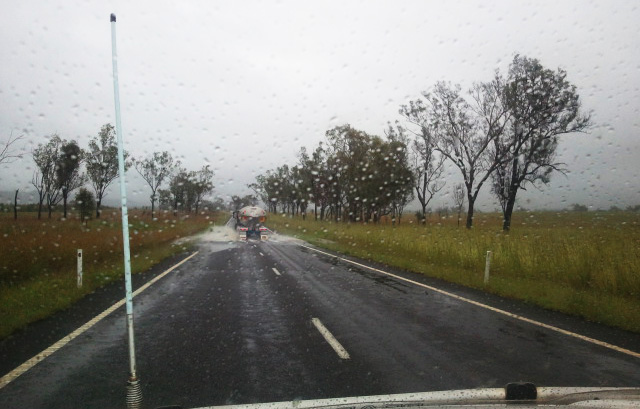
We were relieved to tuck ourselves behind a big fuel tanker heading inland. We figured if we got nice and close as he headed through water we’d be safe. Except if he started going sideways… and we decided not to think about that!
I took most of these shots on my mobile phone – but you can get the gist of the general wetness!
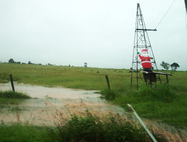
This inflatable Santa someone had propped up on an old windmill tickled me – I suspect he may be useful as a flotation device before the festive season is out!
My real horror moment came as we stocked up in a town halfway home (1 1/2 hours into the journey) and realised that I had the car keys to my brother-in-law’s car in my pocket. In the frenetic early-morning packing of our car, I had forgotten I had them. I nearly passed out from the shock – I had effectively stranded a family of six two hours away from home. In the middle of a flood. Thankfully we managed to find someone heading back the way we came, and handed over the offending item. (But I would worry about the keys making it to them for another 18 hours.)
We continued on our way fully loaded with supplies. There was a lot of shallow water over the roads along the way, but things didn’t get REALLY nerve-wracking til we hit our home town (50km from us).
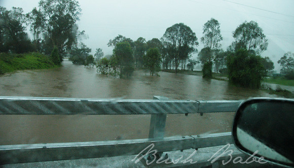
This water was about 1 metre under the new ‘high’ bridge leading into town.
Impressive. In a ‘CRIKEY’ kinda way.
After stocking up on some extra wine at the last pub on the road (hey, a girl has gotta be prepared) we headed south, on a roundabout route to home. A lot of phonecalls made while we were on the road alerted us to all the flooding locations which would stop us reaching our destination – there were some massive washouts and lots of bridges underwater.
The bridge in the photo above was JUST about to go under …
The water splashing up over the side of the structure as we crossed…
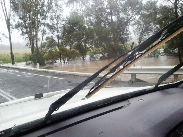
Then we were on the dirt – always more tricky as less people travel them to report their condition.
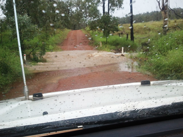
The above flooding doesn’t LOOK too bad, but actually had a reasonably big washout on the right side making it quite treacherous.
And then, just a few kilometres from home…
THIS.
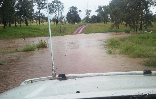
Gads! This creek was about 30 metres across at the crossing… and runnning FAST.
What to do next?
(to be continued…)

4 Comments
Catch the Kids
Great photos! Unbelievable water after so many years of drought!! We lived in the Isa for a few years and often travelled overland in similar situations. Dirt roads can be so scary in the wet.
Catch the Kids´s last blog post ..Christmas Halleluia or The Cleaning Was Done By Others
Bush Babe
Couldn’t agree more… not sick of it yet, but admit I don’t know where the water is going to GO shortly!
A Novel Woman
Holy cow! This is terrifying!! We had a similar situation at our cottage on the lake, and it also has a dirt road leading into it and a lot of hills, so I get it. There is also only one road in and out, and the little bridge was washed out. But we weren’t THERE at the time. I can’t believe you had to face that with kids in the car. I’d be freaking out.
(ahem) Please hurry up and finish the story.
Pleeeeease.
A Novel Woman´s last blog post ..Ho Ho Hope for the Holidays
Jindivick Wildlife Care
You leave us hanging??????
Jindivick Wildlife Care´s last blog post ..What a storm!!